


February 19, 2026
MOS’s New Book On Public Space, Power, and Communication
Rather than delving into rhetoric analysis or theoretical references, Public Spaces NY (Park Books, 2025) opens from a position of evidence—an insistence that public space is never neutral, and that its political, economic, and social forces can be measured, mapped, and made visible. Drawing on more than 20 years of architectural practice, teaching, and direct engagement with public projects, Hilary Sample and Michael Meredith, founders of MOS, treat data not as an abstraction but as a record of lived urban conditions. Occupying a productive middle ground between academia and practice, the book aims to advance evidence-based city design not as technocratic detachment, but as an information tool—one that exposes how assumptions about public life are embedded in zoning, infrastructure, and policy.

Why Public Space Is Never Neutral: Rethinking Urban Design Through Evidence
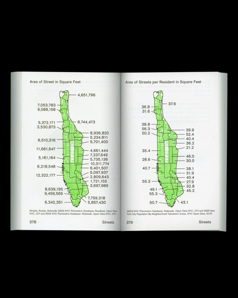
That rigor is matched by an equally disciplined graphic language. Led by Studio Lin, the book’s design uses simple lines, restrained color palettes, and clear organizational charts, translating dense systems into legible knowledge. Familiar facts—such as Central Park occupying roughly six percent of Manhattan—sit alongside more revealing comparisons, including the stark imbalance between 3.4 million square feet of Privately Owned Public Spaces (POPS) and the more than 20 million square feet of bonus private building area granted to developers. Neighborhood-based mappings further expose chronic disparities in funding for libraries, bathrooms, playgrounds, and sports facilities, tracing a long history of disinvestment in low-income communities, while community gardens emerge as a grassroots counterpoint, concentrated largely in working-class areas of Upper Manhattan.
METROPOLIS sat down with the authors to learn more about this book and their practice in general.
I want to begin with the premise that opens the book: there is no neutral public space. How did that idea shape the research, and how should it guide architects and designers working in public space today?
Hilary Sample: For me, it always comes back to where we begin our work—literally where we are sitting. Our office operates between the street and the sidewalk, a deeply public condition. The street we’re on is a commercial corridor with a hospital, police station, schools, and transit. These are all public institutions, all part of the city’s organizational structure. Even when we’re working on interiors, we’re operating within that context. It shapes how we think, how we work, and how we live as citizens of New York.
Through teaching, I’ve spent years looking at public housing—though we don’t even use that term much anymore, which is telling. We talk instead about “affordable housing,” but housing is inseparable from public space. Community gardens are a good example: individuals took responsibility for vacant land and transformed it into public space. Clinics and public hospitals evolved the same way, from small dispensaries into civic infrastructure. So the question of what is public—and who shapes it—has always been embedded in the city’s development.
Michael Meredith: We tend to start with what’s immediately around us because it’s the least abstract. Even though the book relies heavily on public data, it’s grounded in lived experience. We move through these spaces every day, so we’re not just mapping systems—we’re inhabiting them.
From Lived Experience to Urban Data
One thing that stands out is how evidence-driven the book is. How did you decide what to include, and how did data become the narrative engine of the book?
MM: We wanted to show the range of constituencies that shape public space—festivals, protests, farmers’ markets, utilities, infrastructure. These uses produce specific forms of occupation and control. Public space is often imagined as neutral and universal, but it never really is.
In architecture school, we’re taught figure-ground diagrams as if the city were a stable abstraction. This book is a counterpoint to that. It shows public space as differentiated, activated, and contested.
The timing also mattered. We began during the protests [in 2023] at Columbia [University], when access and movement through space suddenly changed. Public space became visible as a political condition, not just a physical one.
HS: That thinking actually started earlier, with our work for the MoMA Foreclosed [Exhibition] in 2011, after the housing crisis. We were working in a small city in New Jersey where the street was effectively the only public space left. Everything else was privately owned.
That project—and later work in affordable housing in places like DC and Paraguay—kept bringing us back to the same realization: the city’s identity isn’t shaped by the skyline as much as by the ground. Neighborhoods change at the sidewalk level.
COVID made that even clearer. Some neighborhoods became empty; others became hyper-local. Storefronts, sidewalks, and streets suddenly carried enormous social weight. Since we work out of a storefront ourselves, we were living this research every day.
That idea of ownership is central to the book. Do you think the way land ownership developed in the U.S. fundamentally shaped how Americans understand—and contest—public space?
MM: Public space always reflects collective values. In New York, about a third of the city’s land is dedicated to cars. That’s not inevitable—it’s a choice. Things aren’t hardwired. The book isn’t saying “this is how it must be,” but rather, “this is how it is now—let’s talk about it.”
A lot of our books are also tools for our own learning. We have hypotheses, we test them, sometimes we’re wrong. What’s interesting is that the book landed at a moment when people were already questioning public infrastructure and privatization—Hudson Yards being a clear example. The question becomes: who is the city for?
HS: We’re also living in an era of constant information, but not always deep reflection. Looking historically helps explain how we arrived here. For example, vaccines used to be administered in police stations. That alone tells you how ideas of public health and public space have shifted.
New York is an epicenter of these changes. We’ve inherited systems of ownership that deserve to be questioned. If the book does anything, it’s to keep those questions visible.

Who Owns the City? Land, Infrastructure, and the Politics of Public Space
One of my favorite graphics is the 1-to-6 ratio of Privately Owned Public Spaces (POPS) area to allocated concessions for new privately owned spaces. What did that reveal for you about public versus private interest?
MM: It shows how public space has increasingly been subordinated to private interests. That doesn’t mean private involvement is always bad—utilities, for example, are essential—but the balance matters.
Even social media functions as a kind of public space that is entirely private at its core. That blurring is one of the defining conditions of contemporary public life. The book tries to show all these forces together, rather than isolating “one villain.”
How did you want to translate such complexity graphically into a visual language that feels accessible?
MM: It’s months of iteration. Simplicity takes time. We worked closely with Studio Lin, continuing a graphic language we developed in earlier books like Vacant Spaces. But this project required more nuance—gradients, hatches, and organizational diagrams to show responsibility, governance, and process.
HS: Representation is always part of our architectural thinking. Lines carry information. When they accumulate, they distill complexity into something legible. Accessibility matters—to students, to non-architects, to the public. This book is an extension of that ambition.

The Future of Public Space: Streets, Protests, and Evidence-Based Urban Change
The book ends with protest, events, and a speculative section that invites readers to rethink typologies and uses. What role should architects play in designing for these softer, temporal layers of public space?
HS: The city feels different after COVID. There are more dogs, more children, more street life. Despite everything, there’s a softness that’s emerged. Public space reflects that.
MM: The final section proposes reclaiming parts of streets—not unlike what we explored in Foreclosed. Streets are vast reserves of public land. Even reclaiming a portion could produce parks, green space, and amenities. These are speculative drawings, but grounded ones.
HS: Our system of blocks and lots is not immutable. Zoning, basements, flood maps—there are ways to rethink space responsibly. Community boards, originally health districts, could play a stronger role. Public space and public health are deeply intertwined.
What changed in your own understanding of public space after making this book?
HS: It heightened my awareness. Especially of sidewalks—who owns them, who maintains them, who moves through them. Public space is something we rush across without noticing, but it carries enormous social and historical weight. The book opened more questions than it answered.
MM: That’s exactly the point. Public space can’t be solved by one person or one book. It’s a collective conversation. We wanted to contribute to that—by framing issues, offering data, and imagining alternatives.

Would you like to comment on this article? Send your thoughts to: [email protected]
Latest

Products
Dorothy Cosonas Designs Textiles from the Fiber Up
The creative director carries forward Luum’s legacy of material innovation through close collaboration with mills and an emphasis on fiber-level experimentation.

Viewpoints
Antoni Gaudí, On the Spectrum
World Heritage Site, Casa Batlló, is “committed to autism.” Can other cultural institutions learn from this ground-breaking neurodiversity initiative?