


December 23, 2025
New York Showcases the Next Generation of Flood Resiliency
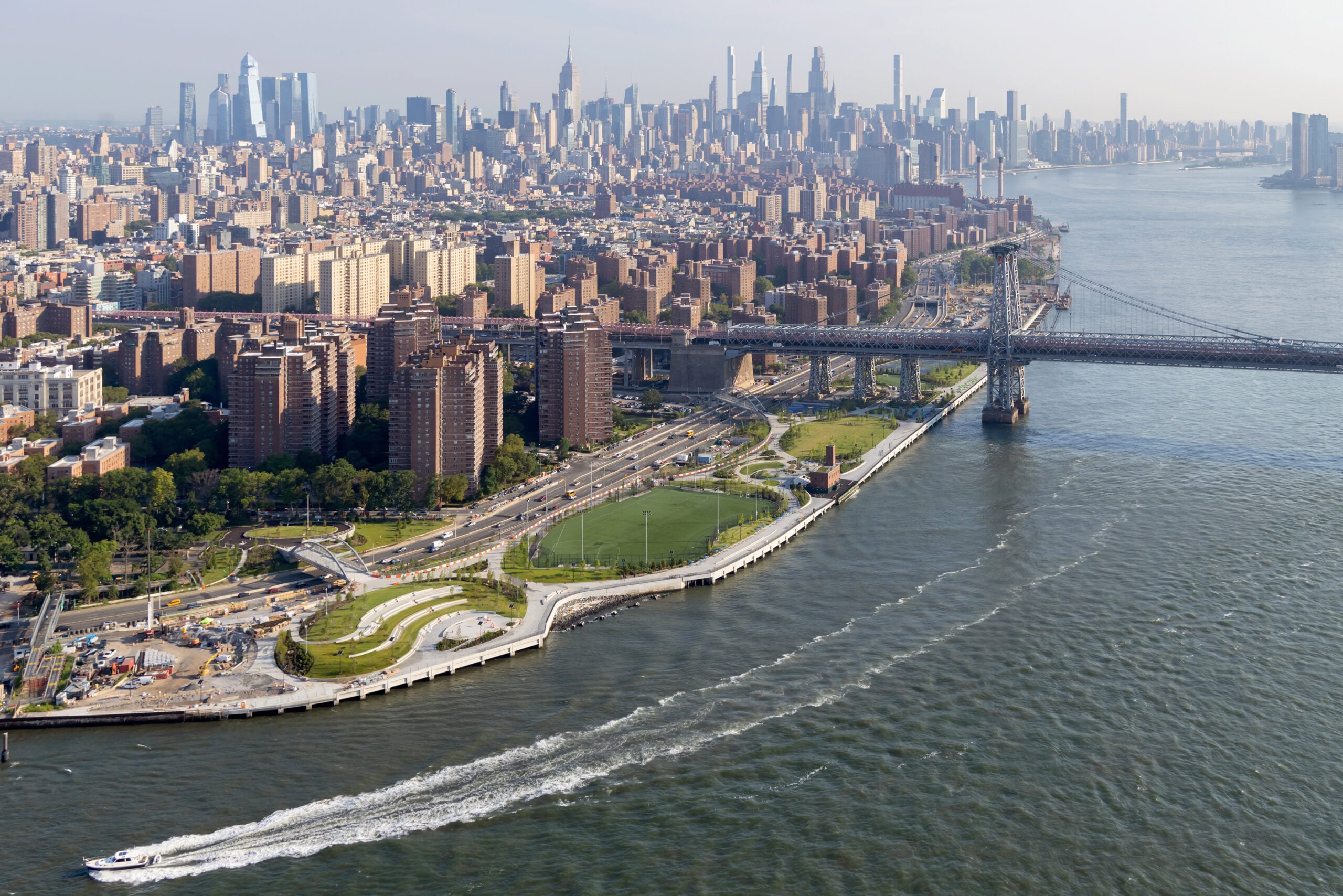
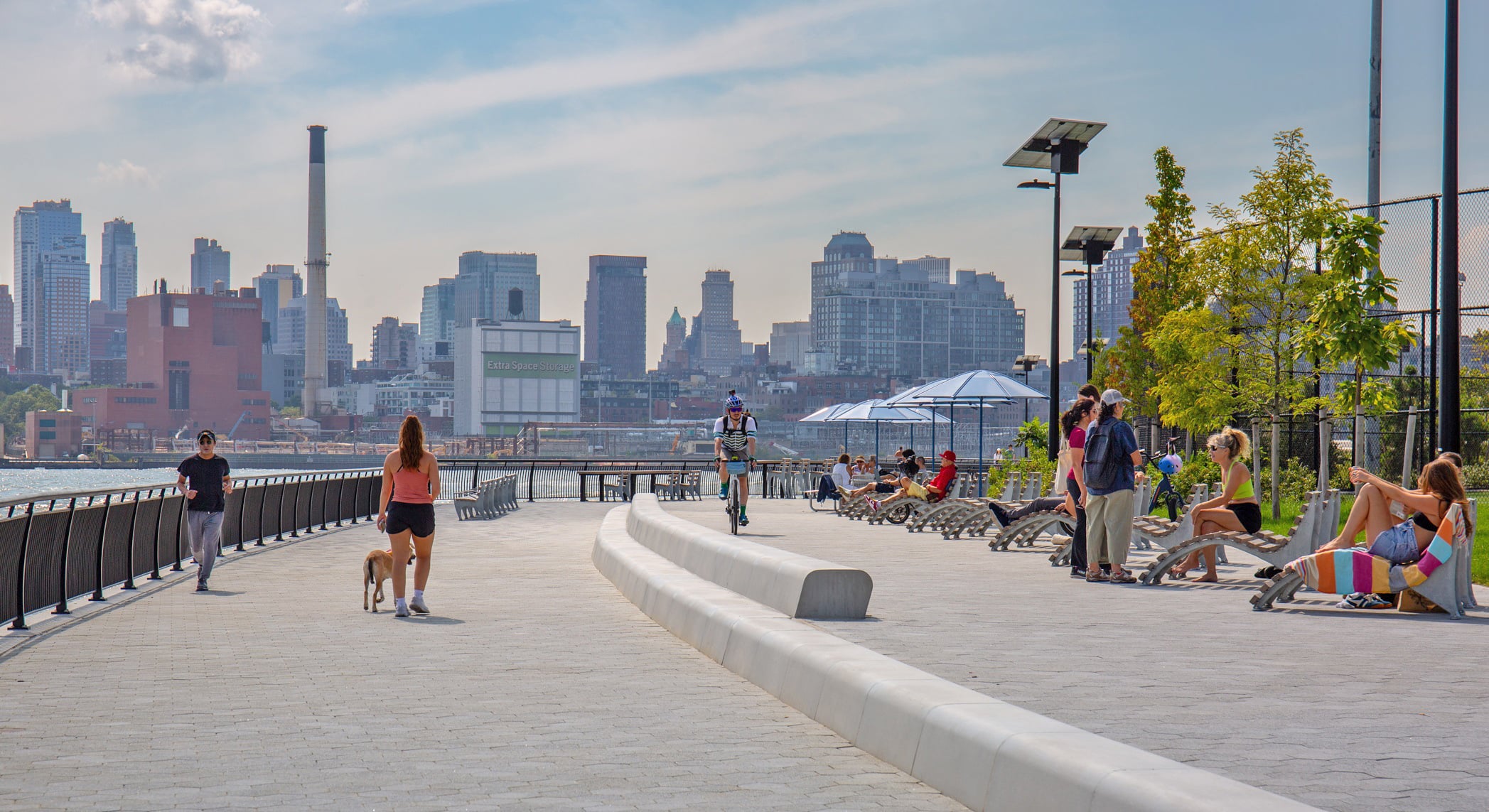
Visitors to the freshly opened sections of East River Park in Lower Manhattan may find it, despite the same sweeping views of Brooklyn and the Financial District, somewhat unrecognizable. Gone are the ball fields perilously close to the water’s edge, patches of pavement in various stages of splitting, and the crumbling but much loved concrete amphitheater. In its place now is an undulating, grassy landscape hosting program spaces like huddles of picnic tables, sinuous planting beds, bike paths, rehabbed structures, and modern site furniture.
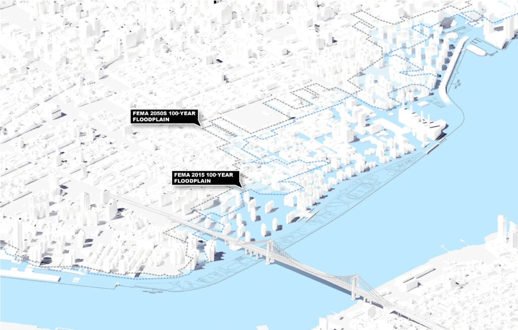
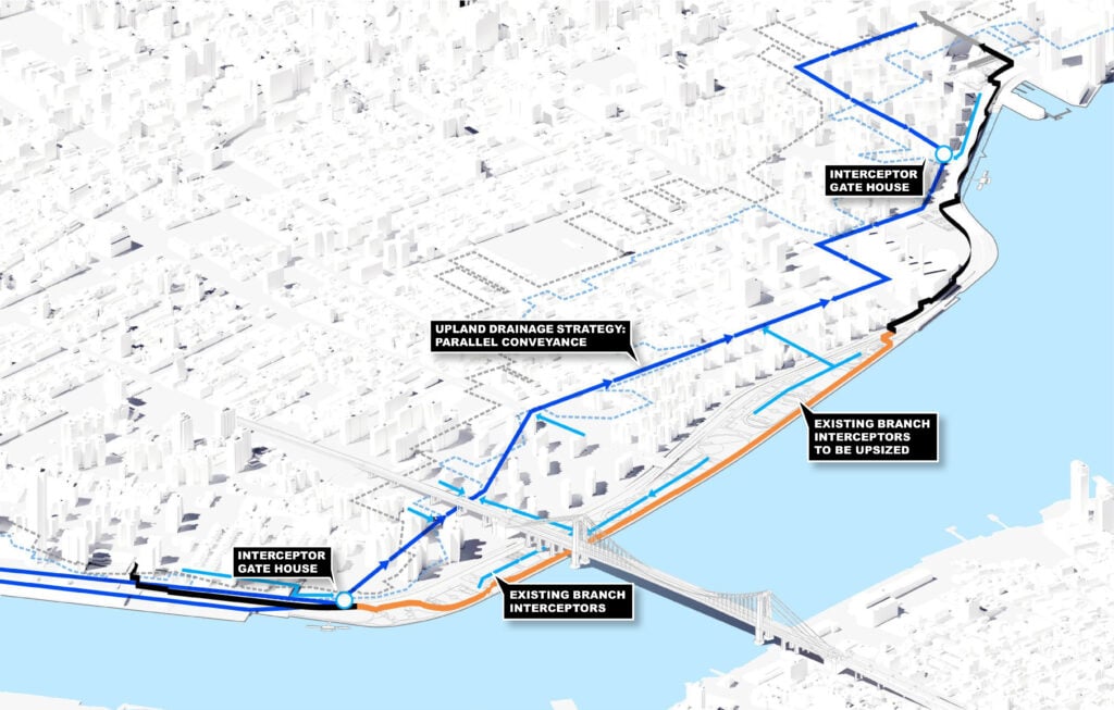
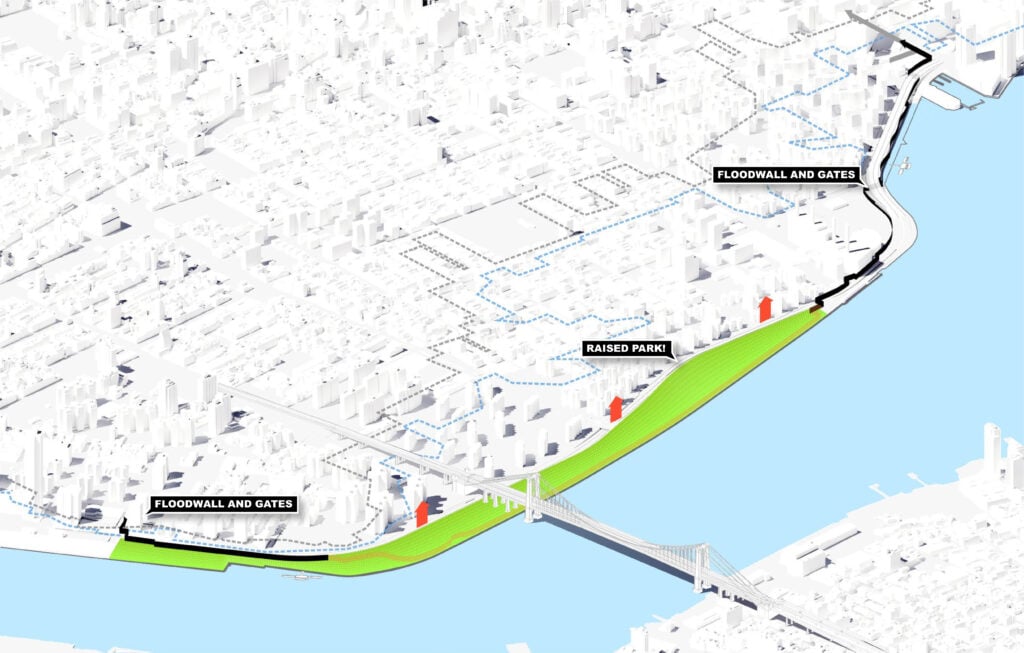
But the project’s most significant contribution was not just to provide de rigeur landscape design. East Side Coastal Resiliency (ESCR), as the broader work along the Lower East Side and East Village waterfront is known, delivers generational flood resiliency through a subterranean flood wall and berm that runs along the spine of the park. The aim is to shield the community from inundation, the likes of which it experienced in a big way in 2012, when Superstorm Sandy sent floodwaters nearly 14 feet high into the neighborhoods behind the new park – primarily NYCHA public housing and residential co-op buildings.

The First Phase of “BIG U”
ESCR’s Project Area 1, centered on East River Park, involves raising the waterfront park’s topography and is nested within the so-called “BIG U,” which had its origins in the post-Sandy, US HUD–sponsored Rebuild by Design competition. Conceived by Bjarke Ingels Group (BIG) and implemented primarily through city agencies, it envisions a network of parks, berms, floodgates, and floodwalls that insulate Lower Manhattan from creeping sea levels and storm surges.
On a recent crisp morning, Eric Ilijevich of the city’s Department of Design and Construction and Jeremy Siegel, project manager at BIG, offered a glimpse into how the newly opened parts of ESCR deploy the full gamut of flood protection infrastructure to protect hundreds of thousands of homes and businesses.
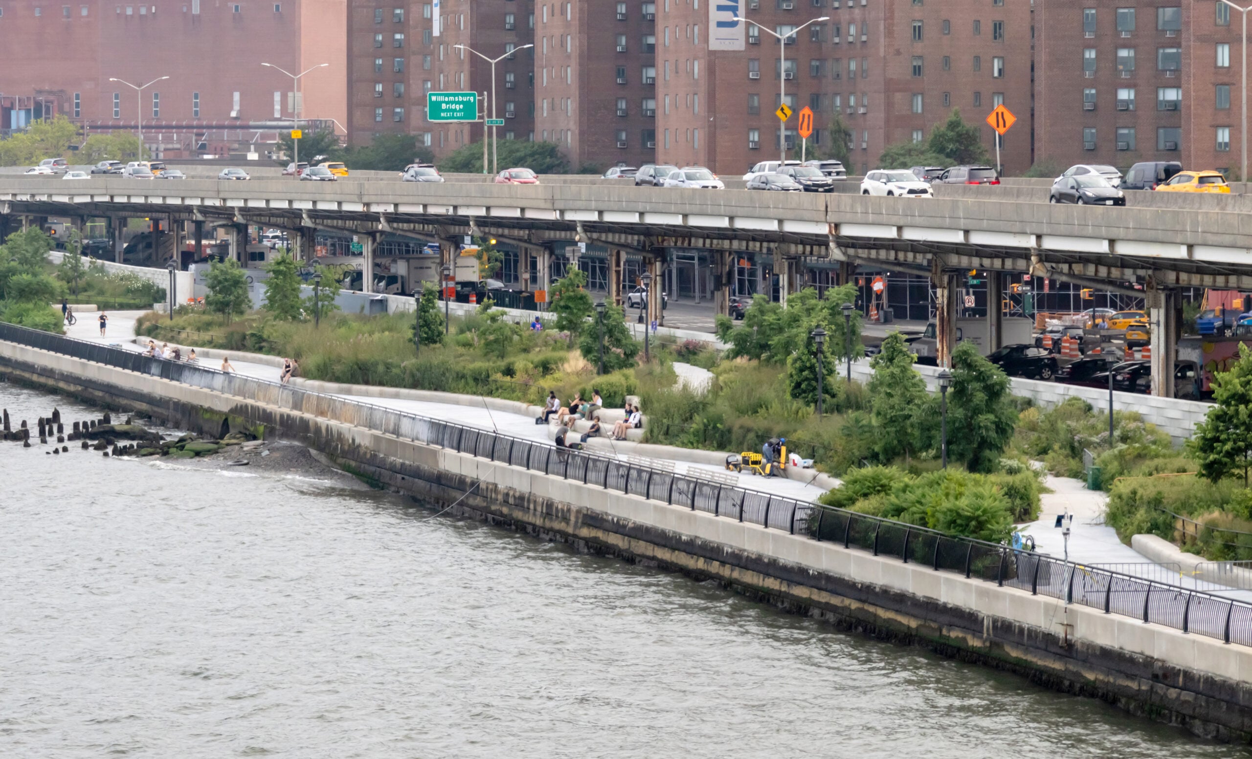
“This was a place where you combine hazard and exposure, and you get risk,” Siegel said, referring to the dense development just across FDR Drive. That risk is largely mitigated by a bermed-over underground wall that is built to provide passive flood protection for decades. “The beauty of a sheet pile wall below ground is that it isn’t exposed to the elements and is tried and true,” Ilijevich said. The wall and the lawns atop it raise the park’s elevation to three levels above river level: approximately 8 feet, 16 feet, and 24 feet, enough to handle projected storm surge. At Corlears Hook, the natural high point, the design and construction team took advantage of the existing grading to link the neighborhood and East River Park across the FDR with a new steel bridge with an ADA-accessible slope that obviates the need for bothersome backtracking. A similar bridge has been added at the Delancey Street crossing, with another bridge to come and others slated for improvements.

Bridging Berms and Flood Gates
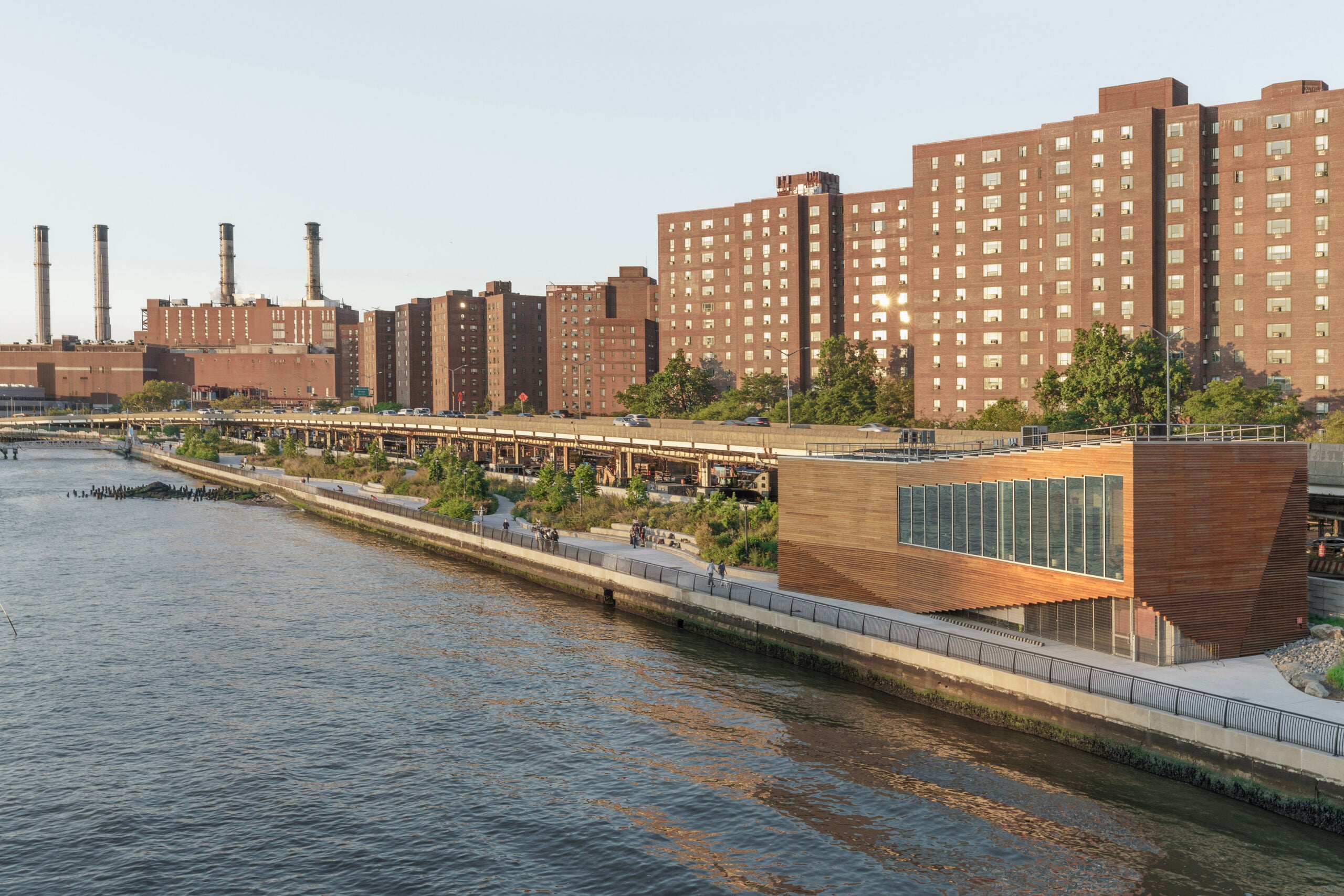
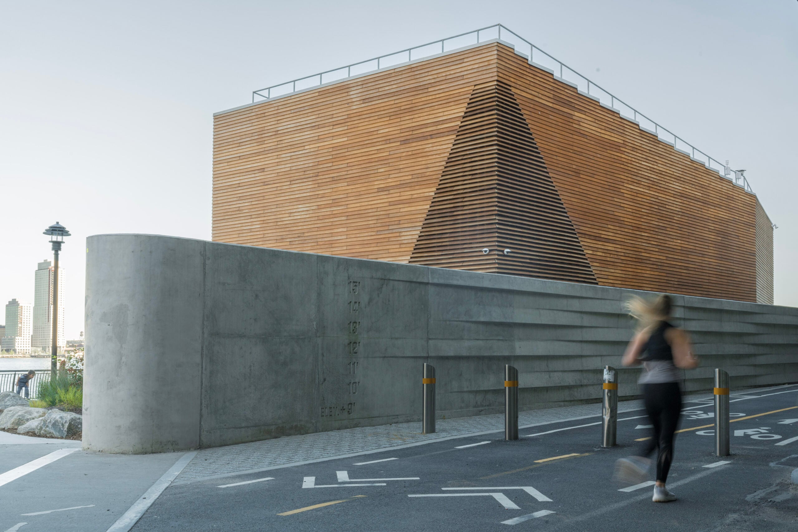
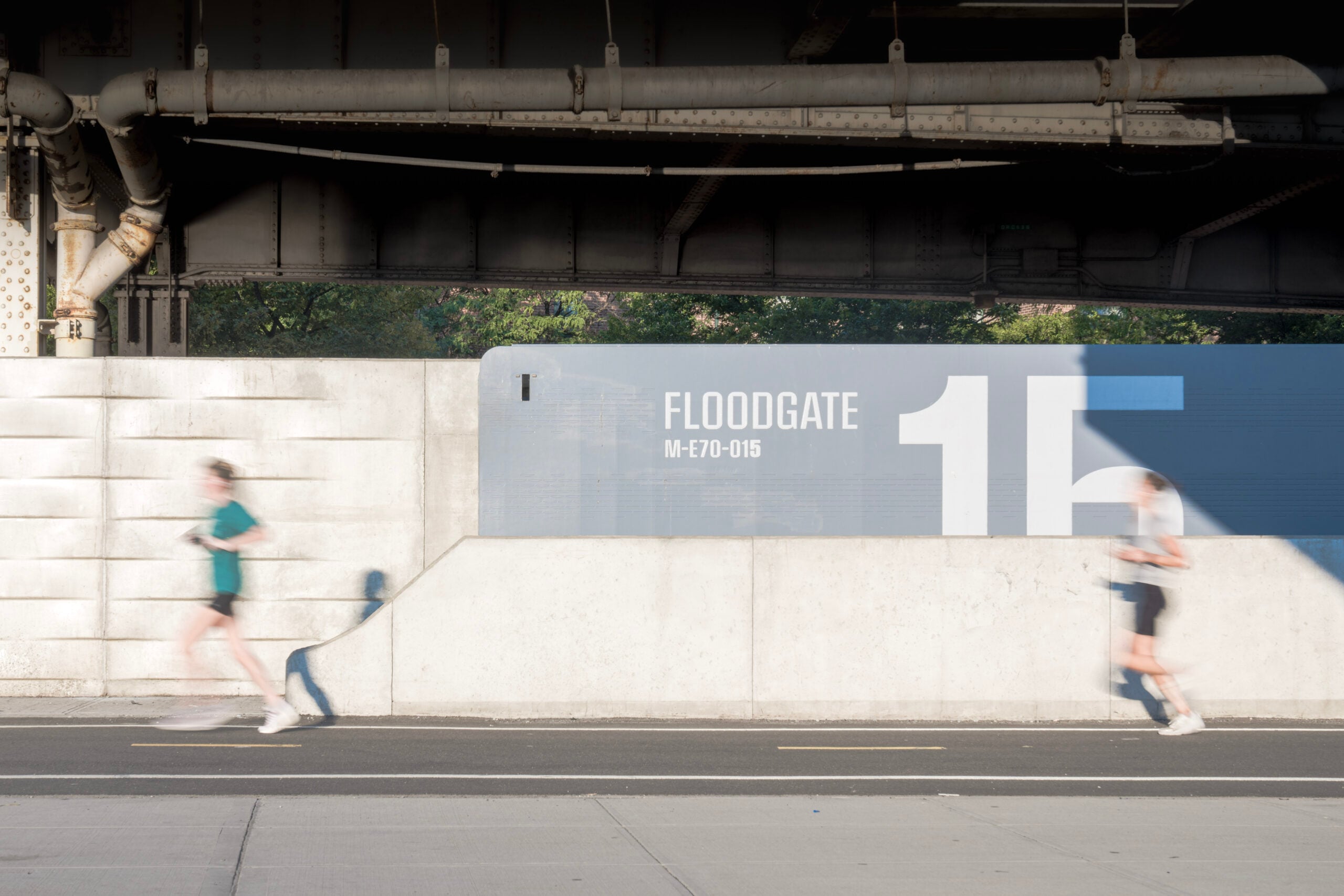
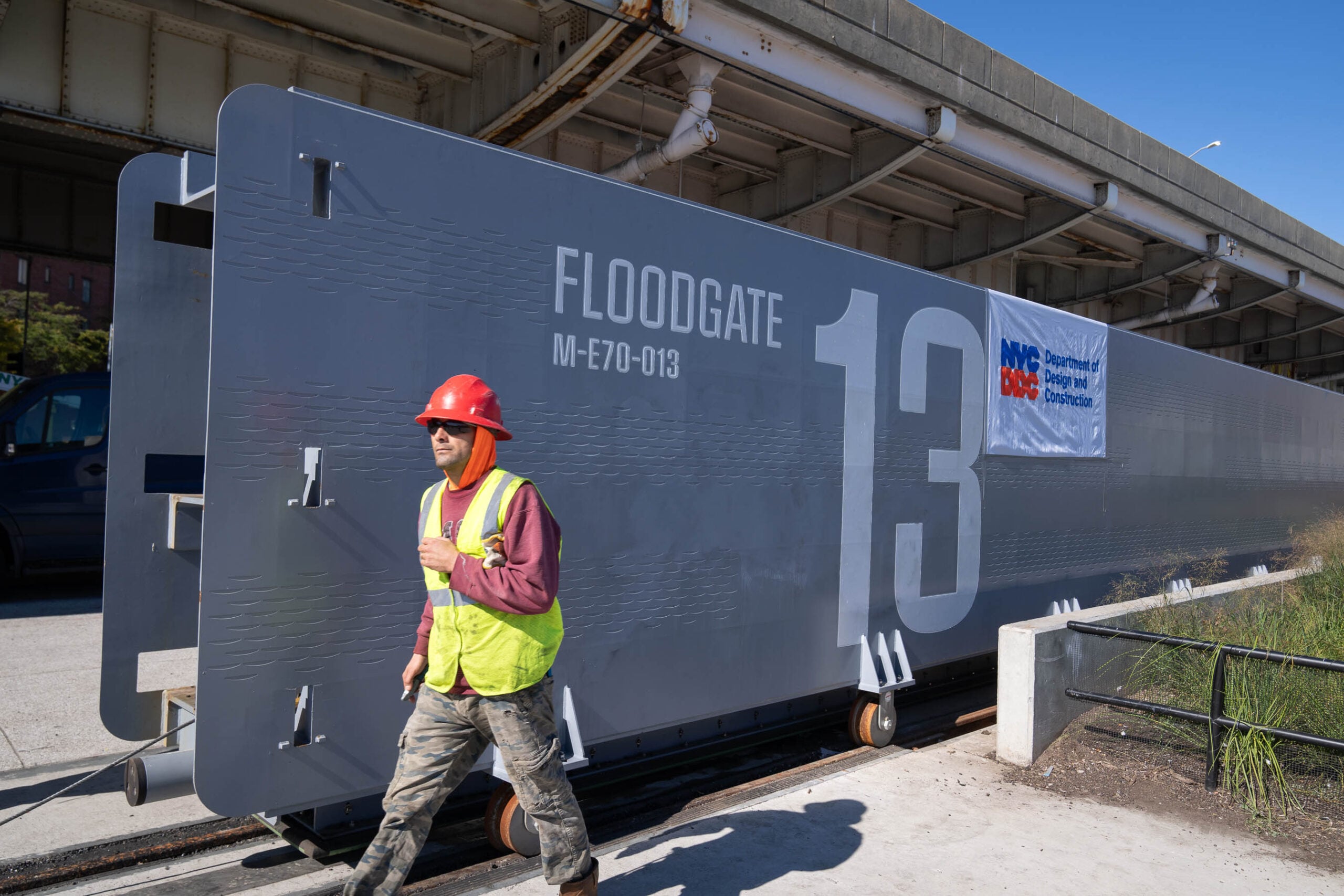
Though the approach to flood protection in the East River Park section of ESCR hewed to a more naturalistic “Bridging Berms” principle, the northern sections of ESCR make use of above-ground, operable floodgates that can slide or swing open as a storm approaches. There, the subterranean floodwall of East River Park emerges above ground and runs below the elevated FDR Drive, providing flood protection in a more visually explicit way. (Other parts of the BIG U, like at Battery Park City and the Financial District, make more extensive use of the operable gates.) The wall and gates themselves can’t be adorned or planted to enable regular inspection, but Ilijevich said they do have “concrete formwork with a wave pattern depending on users’ interface with it” – walkers, runners, cyclists, or drivers. “The waving creates a sense of scale and acts as a subtle wayfinding,” Siegel added. Elevation markings and floodgate numbering offer further bits of navigation aid and public pedagogy.
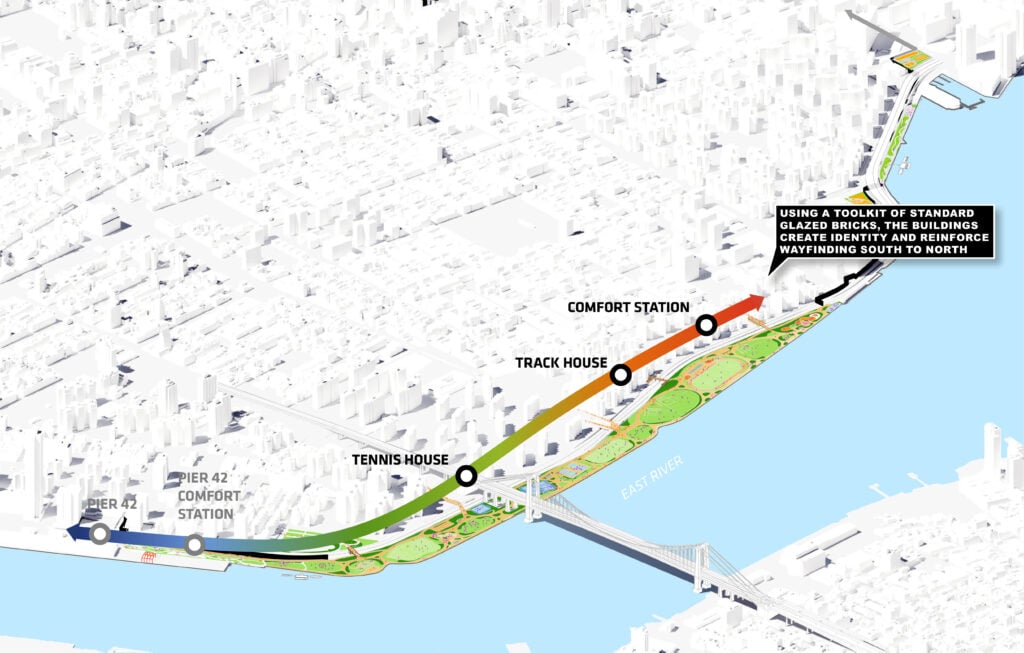
Aesthetically, the new park is spare and rugged — with a material and planting palette that suggests the durability and scale of earthworks — punctuated by bursts of color on furnishings and in three comfort stations (as allowed by Parks Department design standards, Siegel said). At Delancey Street, the dominant gray floor tiling and metallic furniture are interrupted by a streetside, exuberantly colored basketball court, which also helps spread program areas across the park’s tiered elevations. There’s also a new-and-improved amphitheater, Ilijevich said: “The previous design was a concrete slab, but the new tiered approach introduced lawns.” A slight dearth of shade there, as the trees grow in, will be remedied by a Parks Department canopy that’s being fabricated. The planting palette, meanwhile, is “native, resilient, and diverse,” according to Ilijevich, an improvement from the prior, beloved mature trees that he says were selected in a past generation of landscape design.
Beyond ESCR’s added infrastructure, the project also formed and deepened the relationship between federal bodies like FEMA and local agencies over the course of a decade. It also helped crystalize a consortium of local design and engineering specialists, from Mathews Nielsen Landscape Architecture, which selected the dozens of tree and plant species, to ONE, which, as Siegel puts it, helped the project “land in the reality of New York City” – not to mention the dozens of community groups, policymakers, and laborers who shaped and helped realize it. It’s a technical, administrative, and logistical muscle that will need to be constantly strengthened as the city races to expand flood resilience and head off the next big storm.
Would you like to comment on this article? Send your thoughts to: [email protected]
Latest
Projects
Is Structural Stone the Key to Decarbonizing the Built Environment?
Architects in the UK, France, and India are reevaluating stone’s potential as a strong, fireproof, and low-carbon building material.

Viewpoints
3daysofdesign 2026: Vibe Over Spectacle
This year’s 3daysofdesignbypasses the frivolity of its counterpart to focus on fresh innovations in adaptability and sustainability and how they might be introduced within our interiors